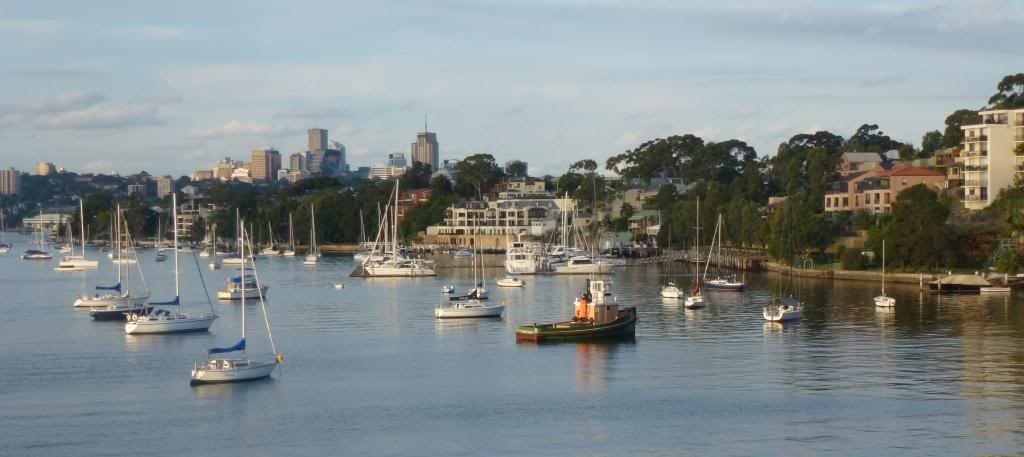
Friday, 4 May 2012


4.2.1  
Balmain Wharf is always busy, ferries go to Circular Quay and to Darling Harbour. 


There is a little park right at the wharf, ideal to sit and watch the activities on the harbour. 

Balmain is one of the oldest suburbs of 
Sydney with lots of history.


It is not always possible to walk right at the waters edge, so I keep as close as possible by walking along the nearest streets and often in little lanes, discovering interesting places.


It is not easy to find your way to Simmons Point, but it is worth it, even if getting a little lost on the way.


 It is so tranquil there and the view is superb: Harbour Bridge, Goat Island, Mort Bay, Ballast Point. 


There is an old Wharf and Workshops, 
classified by the National Trust. 

4.2.2  
Up some steps again, a short way along Nicholson and Duke Street, and down to another little foreshore park.


At Mort Bay are the Tug Boat Berths and Ferry Depot.


The Colgate factory used to be there, the building have been converted to apartments. 


More up and down some more little streets and lanes, a short distance even along Darling Street, and always keeping as close to water as possible takes you to Balmain-Thames Street Wharf. 
And then onto Mort Bay Park. 


This was the site of the first large scale dry dock and engineering workshop in Australia. it was established in 1855 and operated till 195. During WW2 Naval vessels were build here.

Mort Bay Park is a large waterfront park with a big playground. 


4.2.3  
Where Mort Bay Park ends Ballast Point Park starts. 


Here, like at many headlands sandstone was quarried but not for building but as ballast for the ships going back to England after delivering supplies to the colony in 1788 - 1806.
Ballast Point was used till 1990's a Caltex crude oil storage facility. 
In 2002 the site was returned to the public and the park was opened in 2009. 
It is amazing how much the trees then planted have grown since. 


The remnant of Tank 101 has been kept. 
There is a lot of information about the history of this place on display. 
I spent a lot of time in this beautiful park with great views.  
From here walking all the way along Wharf Street one gets only a few glimpses of the harbour in between the houses. 
At Birchgrove Park I stop for the day. The 441 bus goes from here via Balmain and Victoria Road back to the City.
Waiting for the bus I noticed a tiny castle built from sandstone in the park. 


Must be lovely for kids to play in a 'real' castle.


Harbour Walk 4.3  
April 2012  
almost 5 km   
over 2 hours 
BALMAIN PENINSULA
BIRCHGROVE

 The last stretch along the Balmain Peninsula will take me from Birchgrove Park to   Iron Cove Bridge.


4.3.1  
With the 441 Bus I get to Birchgrove Park.
There are sport fields, including tennis courts and a football oval, a fanous one, supposed to be 'The Birthplace of Rugby Union in Australia'.


A path goes along Snail Bay. The view is superb.


Then along Louisa Road to the headland.


In between the long row of houses is a vacant block of land, a little public open space with a nice view of Snail Bay.


Louisa Road runs a long a narrow ridge, the houses on either side have water frontage. 
Those on the eastern side have City views,


and the ones facing west overlook Cockatoo Island.


There are some old houses, mostly terraces and some modern ones, but no apartment blocks.


The properties here looking well kept and pricey. 
At the end of Louisa Rd, at Long Nose Point is a little park, the Yurulbin Park. 


The local council put up an ‘Information sign on Aboriginal People who lived in and around the Leichhardt district’. 
 At the Point is Birchgrove Wharf. The ferry service is not so frequent from here and due to maintenance ferries have been suspended till middle of the year.
Back along Louisa Rd, this time on the other side of the road of course. Louisa Rd goes further than Birchgrove Park where I started off. 
Few town houses and apartments buildings appear.


4.3.2    
Now and then hidden steps lead to the water's edge with little green spaces.  Sometimes old machinery, remnants from long forgotten times are left standing. 


Behind and below Birchgrove Rd is Hopetoun Quays, a big townhouse complex and marina recently been built on a site which once was a coal mine and was later used for fitting out  ships. 


So good to have access to the waterfront. At the end of the boardwalk steps again, 122 of them, leading back up to Gow Street.  I did not realise that at northern end of the complex a public lift could have taken me down - and up again. 
When I go on walks I do have a local map with me, but I prefer to just walk along without following the map. However I do note down street names so that later I can trace my steps. Of course that way I often finish up at dead ends and have to go back, but I do discover interesting little spots. 
Soon many steps down again leading to a park with steep sandstone cliffs, Fitzroy Avenue Park. 
And there it is: 
The Dawn Fraser Bath. 
Unfortunately it too is closed for repairs. Next summer I will go there and swim a few laps, just to take me back when I as a teenager belonged to a swimming club. 
From there it is a short walk to Elkington Park and White Horse Point. Good view again of Cockatoo Island. 


Walking past Balmain Rowing Club, established 1882, another big older apartment complex dominates the scenery.


How could they ever build houses without balconies? 
But looking at them closer I had to admire the art work some residents put up. 
And also nice to see neat small vegie patches.


Walking along the Reserve in front of the buildings I disturbed  a flock of seagulls being fed.


The Reserve ends at Elliot Street Ferry Wharf. there is a nice restaurant.

4.3.3
Off Elliot Street turning into little lanes and unexpectedly I got to the foreshore again. Further on some roads would have taken me there too.  

More large town houses and apartment blocks where once factories stood. 
The good thing with these new housing developments is that the foreshore has been made accessible to the public and some nice park land has been created.

Some plaques at the Pump House ‘A’ of the old Balmain Power Station and more around the walk way give interesting information of this gone-by era.


And there we are at Iron Cove with its bridge.


Actually two bridges. 


The original 1882 Iron Cove Bridge was replaced in 1955, and after some controversy a second bride was completed in 2011 to easy the traffic on Victoria Road. 


It was getting late, because todays walk had lots of interesting spots, and because I started only in the afternoon, and because the sun sets now earlier.


The April Balmain Peninsula walks from bridge to bridge were real fun. 

Long walks are good - at least for me.